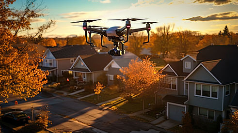
Aerial Perspectives
Visual Immersion by Drone for Innovative Projects
Dynamic reporting
and captivating, immortalized by drones:
Photographs, videos...
Aerial shots perfectly enrich TimeLapse projects, providing a global perspective on the sites. They offer the opportunity to place your projects in their environmental context, while revealing unexplored perspectives.
Driven by this passion and rigor which characterize our approach to Time Lapse, we have, for more than two years, broadened our skills to aerial productions.
As professional civil drone operators, we are registered with the Directorate General of Civil Aviation (DGAC) and we strictly comply with current regulations, having all the required authorizations and insurance coverage.
Our full-time remote pilots embody our company's commitment to providing superior service. This integration ensures deep expertise and familiarity with each project, without resorting to outsourcing.
Specialists in aerial capture for construction sites, our remote pilots deploy their know-how to promote your initiatives and projects.

Aerial photography services provided by drones find application in a variety of professional sectors for the inspection, control, measurement or evaluation of buildings, infrastructure or land of all types.
With high definition and 4K resolution, these premium aerial images can be displayed or printed in large format on a variety of media, providing fast and cost-effective solutions.
Each capture is carried out in accordance with safety rules and in compliance with French airspace regulations. The drone allows shots to be taken from the ground up to a maximum altitude of 120 meters, offering varied and unique perspectives. In urban areas, a flight authorization is required to take the photo.
Aerial drone imagery is valuable to a wide range of professionals, including but not limited to construction, public works, agriculture, industry, commerce, crafts, as well as real estate and insurance, among others. This technology is frequently used for inspections, checks, presentations, but also for applications such as thermography and mapping, whether to assess the condition of a road or a roof, measure the extent damage to a structure following a storm, or identify heat loss.

Exquisite Aerial Captures
And Innovative
Drone Instinct elevates your project with a range of exquisite aerial captures, encompassing photography, videography, and 360° drone immersions, designed to support your initiative from start to finish.
Our services transcend simple aerial capture to offer exceptional cinematographic productions entirely captured by drone, merging harmoniously with timelapses or terrestrial reports for a complete visual narrative.
Equipped with the most advanced technology, our drones integrate the latest generation gyro-stabilized sensors, guaranteeing 20 megapixel photos and 4K UHD video sequences of incomparable fluidity and stability, enhanced by the expertise of our remote pilots. .
We optimize each aerial session by offering a combination of videos and photographs, thus maximizing the use of each flight to enrich your visual collection and enhance your project from all its angles.
Our collective of operators, all rigorously trained in aerial capture techniques, is ready to intervene on the national territory, from our strategic bases in Ile-de-France and the South of France.
Drone Instinct listens to design tailor-made solutions that meet your unique aspirations.
*Except in exceptional cases or for missions requiring specific skills not available internally.
Panoramic Visions
Aerial
Immersive and Detailed Exploration
Aerial panoramas embody an innovative fusion of drone captures, providing a comprehensive and captivating perspective of a location. Thanks to the precision of the finely assembled 20 million pixel shots, these works allow a deep immersion in the image to explore every detail with remarkable clarity.
These panoramic views, easily accessible via a web browser and adapted to a wide range of devices such as smartphones, tablets, and virtual reality headsets, integrate perfectly with your website, enriching the user experience.They constitute a a valuable tool for revealing the splendor of a site as well as its surrounding context — stations, access roads, shopping centers, educational establishments — thus offering unparalleled enhancement of the assets of your project.
The 360° panoramic view reveals the harmonious integration of the project into its setting, the proximity to essential services and transport routes, as well as the surrounding tourist attractions. The integration of real-time feeds from our construction site monitoring devices and timelapses enriches this exploration, with, for example, direct access by clicking on our logo below.This service can be offered as a separate service entire or combined with a complete report including photos and drone videos.


